Red Butte: Remnant of the Flood
by William A. Hoesch, M.S. *
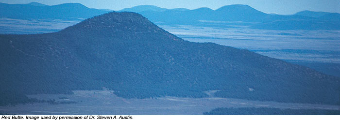
Sixteen miles from Grand Canyon's south rim, a cone-shaped butte rises like a lone sentinel 1,000 feet above the Coconino Plateau floor. Thousands of tourists rush past on Arizona Highway 64 without giving it another thought, yet this humble little hill testifies to a remarkable past.
Red Butte is composed of flat-lying shales of the Moenkopi Formation, overlain by Shinarump Conglomerate of the Chinle Formation. Continuous exposures of these two formations are not found for tens of miles around, yet they occur here. These strata sit on a foundation of flat-lying and resistant Kaibab Limestone, the rim rock for most of Grand Canyon and surface of the Coconino Plateau. A basalt (lava) flow tops the butte, protecting the softer layers below from erosion. Lava ordinarily flows downhill, so how did it get on top? Answer: it flowed onto a surface that was once 1,000 feet higher than the present Coconino Plateau! Strata of the Moenkopi, Chinle, and perhaps other formations were stripped away by erosion. Red Butte stands as the most prominent vestige of this once continuous layer.
* Mr. Hoesch is Research Assistant in Geology.
Cite this article: Hoesch, W. 2008. Red Butte: Remnant of the Flood. Acts & Facts. 37 (3): 14.